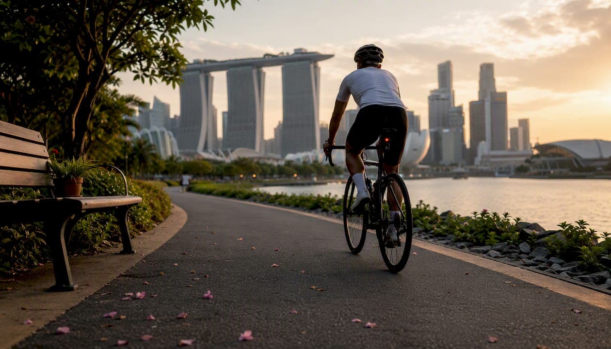
The three loops worth your time in Marina Bay are the Marina Bay – Stadium loop (roughly 8.4 miles, easy, paved PCN asphalt — ideal for families and photographers), the Marina Barrage circuit (a shorter, flatter variant of about 5–6 km, great for kids and casual riders), and the Marina Bay – Kallang Basin extension (medium effort, adds Kallang Riverside Park and National Stadium to a satisfying half-day ride).
- Marina Bay – Stadium loop: ~8.4 miles, easy, flat with a few ramp crossings. Best for families, photographers, and first-timers. Ride it at dawn or after 7:30 PM when the waterfront cools down and crowds thin.
- Marina Barrage circuit: very easy, minimal traffic. Perfect for young children or a quick evening spin. The rooftop green of Marina Barrage is a natural rest point.
- Marina Bay – Kallang Basin extension: moderate. Connects through the PCN to Kallang Riverside Park and the National Stadium precinct. Best on weekday mornings when the path is nearly empty.
Key Takeaways
The Marina Bay – Stadium loop (~8.4 miles, easy) is the best all-around route for most riders, with the Marina Barrage circuit as the go-to for families and the Kallang Basin extension for those wanting more distance.
| Point | Details |
|---|---|
| Best all-around loop | Marina Bay – Stadium loop (~8.4 miles, easy, flat PCN asphalt) suits families, photographers, and first-timers. |
| Family-friendly short ride | The Marina Barrage circuit (~5–6 km) is the flattest, quietest option with a natural rest stop at the Barrage rooftop. |
| Best start time | Weekday mornings before 8 AM or after 8 PM any day for cooler temps and thinner crowds. |
| Get your maps first | Download GPX from AllTrails or RideWithGPS; cross-check closures on the LTA cycling routes map before every ride. |
| Safety non-negotiables | Helmet, front and rear lights, spare tube, and at least 750 ml of water for any loop under 15 km. |
Table of Contents
- What are the Marina Bay cycling paths actually like?
- Segmented ride log: km markers and what you'll pass
- Where to start, park, and access the route by MRT
- Where to rent a bike near Marina Bay
- How to get official maps and GPX files
- Safety rules and shared-path etiquette
- Short, medium, and long route variants from Marina Bay
- Where to stop for food, water, and a break
- What riding Marina Bay actually feels like
- Sources
- FAQ
What are the Marina Bay cycling paths actually like?
The path network here is almost entirely smooth PCN asphalt, with short boardwalk sections near Gardens by the Bay and a few kerb crossings at road junctions. Nothing technical. The Park Connector Network threads Marina Bay into a much larger web of off-road routes, so you can extend a short loop into a multi-hour ride without touching a main road for most of it.
Crowding is the real variable. Weekend mornings from 8 AM to 11 AM draw the biggest mix of joggers, tourists, and families along the Esplanade and Marina Bay Sands waterfront. Weekday evenings are busy too, especially between 6 PM and 8 PM near the Merlion and Bayfront areas. The quietest windows are weekday mornings before 8 AM and any day after 8 PM — the skyline lights up, the air drops a few degrees, and you get the path largely to yourself.
- Path surfaces: smooth asphalt on PCN connectors, short boardwalk near Gardens by the Bay, occasional kerb crossings at road junctions
- Shared-use paths: pedestrians have priority; signal before overtaking
- Weather: Singapore's heat peaks between 11 AM and 3 PM — avoid that window for anything over 10 km
- Rain: paths drain quickly, but the boardwalk near Gardens by the Bay gets slippery; slow down
Pro Tip: Bring a small gear (39×25 or equivalent) if you're on a road bike — the ramps at the Esplanade and near Marina Barrage are short but steep enough to catch you off guard after a long ride.
Segmented ride log: km markers and what you'll pass
The Marina Bay – Stadium Cycle Route on AllTrails is listed as an easy ~8.4-mile loop, open year-round. A longer 25 km variant with detailed km markers is documented by EpicRoadRides, which is the most practical reference for pacing stops.
Marina Bay – Stadium loop (approximate km markers):
- 0 km — Start at Marina South MRT / Marina Bay Sands area. Head toward the waterfront promenade facing the bay.
- 1.5 km — Esplanade and Merlion Park. The Merlion is a natural photo stop; expect foot traffic here even early morning.
- 3 km — National Gallery / Padang. The F1 circuit runs through this stretch — look for the pit lane markings on the road.
- 5 km — Gardens by the Bay entrance. The path skirts the Supertree Grove; the boardwalk section starts here.
- 7 km — Marina Barrage junction. Branch right to add the Barrage loop (adds ~3 km) or continue straight toward the Stadium.
- 10 km — National Stadium / Kallang precinct. The Sports Hub is visible from the path; there are toilets and water here.
- 13.5 km — Return via Kallang Riverside Park back to the Marina Bay waterfront.
For the Plotaroute version of the Marina Loop, the recorded distance is ~7.19 miles with modest ascent figures — confirming this is a genuinely flat ride with only minor elevation changes at bridge ramps.
Pro Tip: Download the GPX from RideWithGPS or AllTrails before you leave home. Cell signal is reliable along the route, but having the file offline means you can follow the track on a Garmin or Wahoo without burning data.
Where to start, park, and access the route by MRT
The most convenient start points are Marina South MRT (Thomson-East Coast Line, exit toward Marina Gardens Drive) and Bayfront MRT (Circle and Downtown Lines, exit B toward the waterfront promenade). Both put you on the PCN within a two-minute ride.
- Marina South MRT: closest to the southern loop entry; bike racks available at the station exit
- Bayfront MRT: best for starting at the Marina Bay Sands / Esplanade end of the loop
- Promenade MRT: useful if you're starting from the Esplanade side and want to skip the Sands section
- Bike parking: racks at Gardens by the Bay (near the Flower Dome entrance), Marina Barrage rooftop, and the National Stadium Sports Hub
- Toilets and water: Gardens by the Bay visitor center, Marina Barrage, National Stadium concourse, and Merlion Park public facilities
- Folding bikes on MRT: allowed on all MRT lines at all times. Full-size bikes are not permitted on MRT — plan accordingly or use a bike-share service from the station
The Onemarinagardens location sits 160 meters from Marina South MRT, which makes it one of the most direct residential access points to the southern PCN entry of the loop.
Where to rent a bike near Marina Bay
Rentals are available in the Marina Bay area, with fleets covering children's bikes, hybrid city bikes, and e-bikes. Some providers include complimentary scenic-route maps — useful if you haven't downloaded a GPX yet. Klook lists bicycle and kick scooter rentals in Singapore with booking options for visitors.
Before you confirm any rental, ask:
- Is a helmet included, and does it fit properly?
- Is there a lock, and what's the policy if the bike is stolen?
- What's the condition of the tires and brakes? (Test both before leaving the shop.)
- Does the rental include a route map or GPX link?
- What's the return policy if the bike develops a mechanical fault mid-ride?
For on-route repairs, the Sports Hub precinct near the National Stadium has the most reliable access to bike shops in the area. Basic repair stands with tools are occasionally available at PCN rest points, but don't count on them — carry a spare tube, tire levers, and a CO2 inflator or mini pump.
How to get official maps and GPX files
The LTA interactive cycling routes map is the authoritative source for Singapore's cycling paths. Check it before every ride for temporary closures or diversions — it's updated by the Land Transport Authority and reflects the actual legal path network, not user-submitted routes.
For GPX downloads:
- AllTrails: search "Marina Bay Stadium Cycle Route" — download GPX directly from the route page (free account required)
- RideWithGPS: search or import the route; export as GPX or FIT for Garmin/Wahoo
- Plotaroute: the Marina Loop route is publicly available for download
- NParks PCN pages: no direct GPX download, but the PCN connector pages show route alignments useful for planning extensions
Pro Tip: After downloading a GPX, open it in a free viewer like GPX Studio or import it into Google Maps before you leave. Check that the file covers the full loop and that the key waypoints (Marina Barrage junction, National Stadium) appear where you expect them. A corrupted or truncated file is a frustrating discovery mid-ride.
Safety rules and shared-path etiquette
LTA and NParks both govern shared paths in Singapore. The core rules:
- Speed: keep to a safe speed on shared paths; no specific km/h limit is posted on most PCN sections, but riding at jogging pace near pedestrian clusters is the practical standard
- Signaling: call out "passing on your right" or use a bell before overtaking
- Footpaths: cycling on public footpaths where it's not designated as a shared path is an offense under the Active Mobility Act — stick to marked PCN routes and shared paths
- Traffic lights: stop at all crossings; LTA enforcement does issue fines for red-light violations on cycling paths
- Lights: front white light and rear red light are required when riding in low-light conditions
Pre-ride safety checklist:
- Helmet on and buckled
- Front and rear lights charged (even for daytime rides that might run late)
- Spare tube, levers, and inflator in your bag
- Water — at least 750 ml for a loop under 15 km in Singapore heat
- Phone charged with GPX loaded offline
Folding bikes are permitted on MRT at all times; full-size bikes are not. Violations carry fines under the Active Mobility Act.
Short, medium, and long route variants from Marina Bay
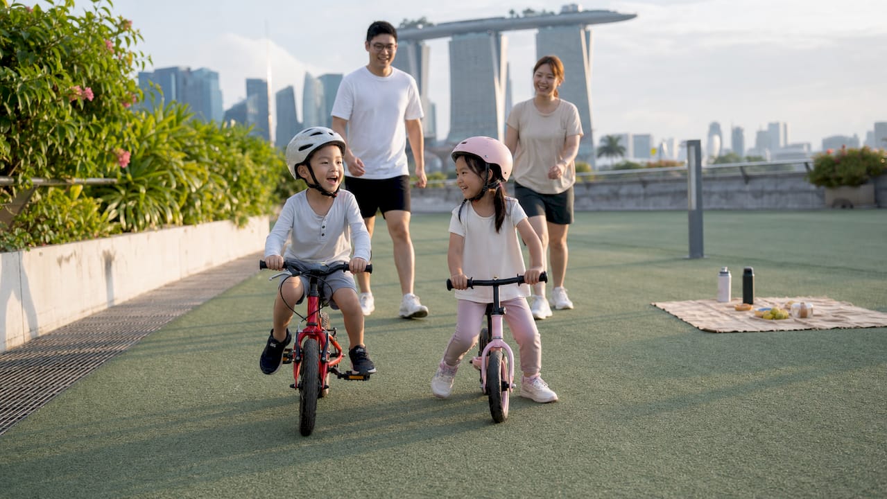
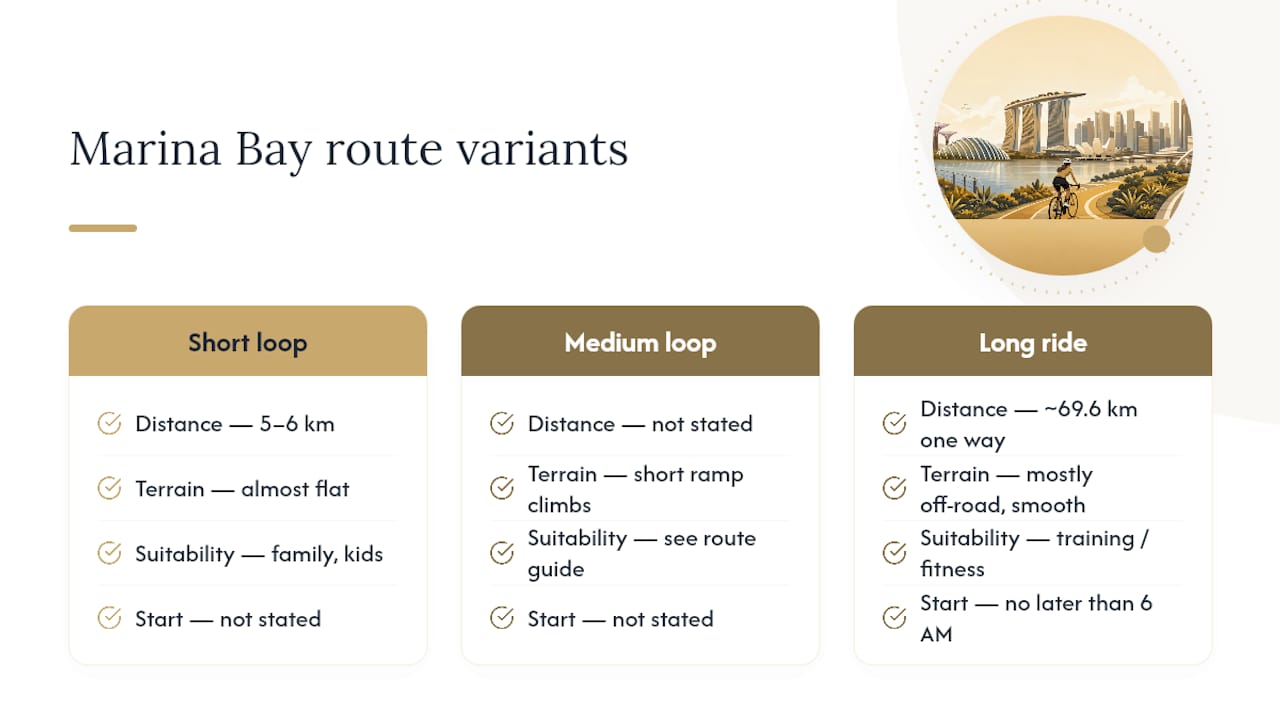
Short family loop (5–6 km): Marina South MRT → Marina Bay waterfront → Marina Barrage rooftop → return. Almost entirely flat, minimal road crossings, and the Barrage rooftop is a natural picnic stop. Suitable for children on balance bikes or small-wheel bikes.
Medium loop — Marina Bay to Kallang Basin: Follow the PCN from the Marina Bay waterfront through Gardens by the Bay, past the National Stadium, and into Kallang Riverside Park. The Little Day Out route guide covers landmarks and navigation tips for this loop. Expect one or two short ramp climbs near the Sports Hub.
Long training ride — Marina Bay to Changi Beach Park (~69.6 km one way): The PCN connects Marina Bay all the way to Changi via a mostly off-road corridor with wide, smooth paths and rest facilities at intervals. Bikemap documents this route at approximately 69.6 km. Carry at least two water bottles, plan food stops at hawker centers along the East Coast, and start no later than 6 AM to beat the heat.
Where to stop for food, water, and a break
The Marina Bay waterfront has cafés and food options at Marina Bay Sands, the Esplanade Mall, and the Fullerton area — all within the first 3 km of the loop. For a mid-ride stop, the Marina Barrage visitor center has vending machines and a sheltered seating area with a view of the reservoir.
- Gardens by the Bay: the visitor center near the Flower Dome has a café and clean toilets — good for a 20-minute break around the 5 km mark
- National Stadium / Sports Hub: hawker stalls and a food court inside the complex; toilets are accessible without entering the stadium
- Water refill: public water fountains at Merlion Park, Marina Barrage, and the Sports Hub concourse
For crowd avoidance, the safest windows are weekday mornings before 8 AM and after 8 PM on any day. Avoid the Marina Bay Sands / Esplanade stretch on weekend evenings when events and light shows draw large crowds. The stretch between Gardens by the Bay and Marina Barrage stays quieter than the waterfront promenade almost any time of day.
Pro Tip: The best photo stop on the loop is the elevated walkway near Marina Barrage, looking back toward the city skyline. Pull off to the left side of the path, lean your bike against the railing, and shoot toward the Supertrees at dusk. Avoid stopping on the main promenade near Merlion Park — it's narrow and foot traffic is constant.
What riding Marina Bay actually feels like
Weekend mornings at Marina Bay have a particular energy: joggers, families with strollers, and cyclists all sharing the same smooth asphalt, with the skyline reflecting off the bay in the early light. The loop is genuinely beautiful, and the flat surface means you can actually look around instead of watching the road. What catches most riders off guard is how quickly the pedestrian density spikes between 8 AM and 10 AM on Saturdays — a stretch that felt open at 6:30 AM can feel like a slow-moving crowd by 9 AM.
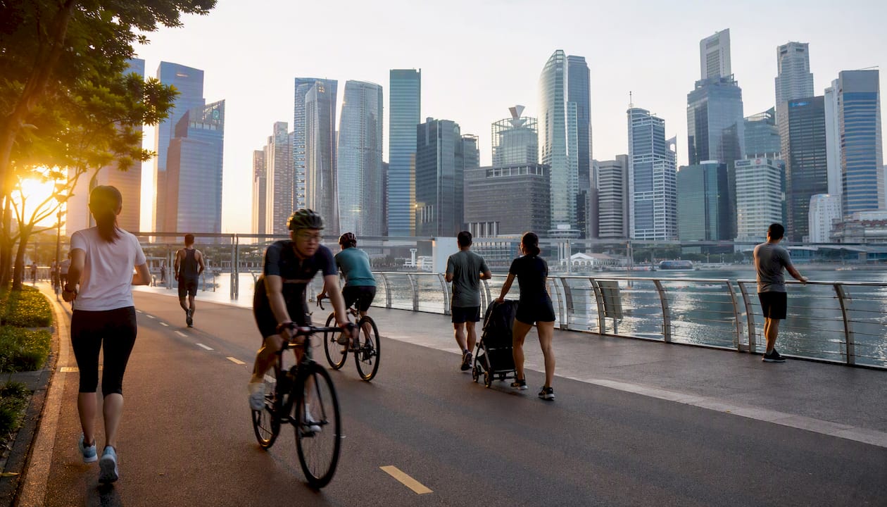
The practical recommendation: start at 6 AM on weekends. You get the best light for photography, the coolest temperatures, and a path that's yours for the first hour. By the time the crowds arrive, you're already on your second loop or heading for breakfast.
Sources
Check these before you ride — official pages are updated for closures and temporary diversions:
- LTA | Cycling Route
- The PCN experience — NERL | NParks
- Bicycle & kick scooter rental — Klook
- Marina Bay - Stadium Cycle Route | AllTrails
- Marina Bay cycling loop + Singapore city highlights — EpicRoadRides
Check official LTA and NParks pages for any temporary closures before heading out, especially around major events at the F1 circuit or National Stadium.
FAQ
How long is the Marina Bay cycling loop?
Can I bring my bike on the MRT to reach Marina Bay?
Folding bikes are allowed on all MRT lines at all times; full-size bikes are not permitted on MRT. The nearest stations are Marina South MRT and Bayfront MRT.
Where can I rent a bike near Marina Bay?
Rentals are available in the Marina Bay area covering children's bikes, hybrids, and e-bikes, with some providers including complimentary route maps. Klook lists bookable options for visitors.
What is the best time to cycle at Marina Bay?
Weekday mornings before 8 AM and evenings after 8 PM offer the coolest temperatures and the fewest pedestrians. Weekend mornings before 7 AM are the quietest option if you want the waterfront path to yourself.
Do I need a GPX file, or can I follow signs on the path?
PCN route markers are present but not always consistent at every junction. Downloading a GPX from AllTrails or RideWithGPS and loading it offline on your phone or cycling computer is the most reliable way to follow the loop without wrong turns.