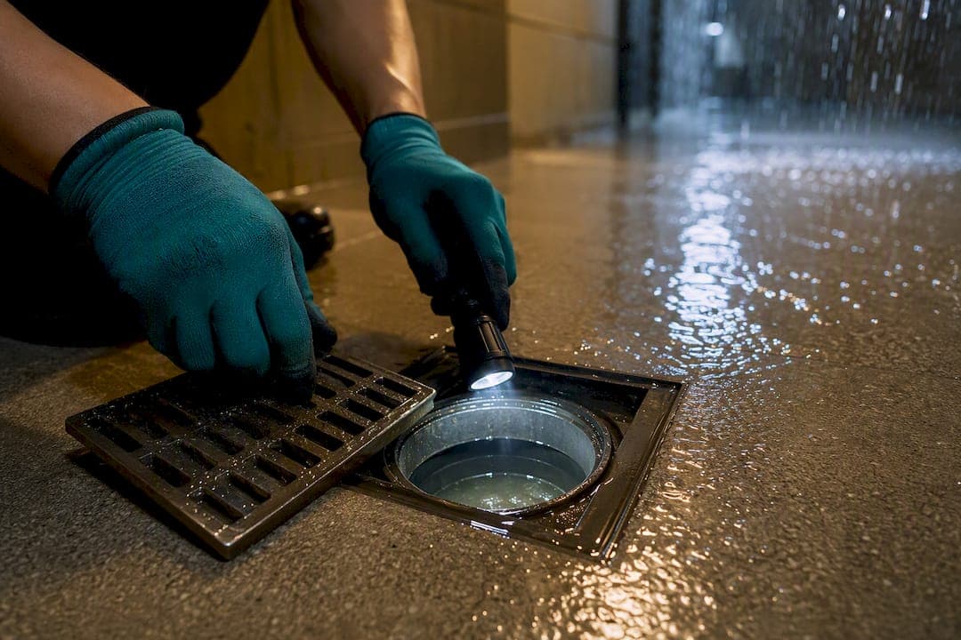
Marina Bay carries real but localized flood risk. The Marina Barrage and its pumping systems shield the area from large-scale tidal and river flooding, yet the March 2025 incidents show that a paved access road or a lift lobby can still flood fast when heavy rain meets a clogged or missing drain. PUB and the Marina Barrage remain the two names to know here, but the weak point isn't the big infrastructure. It's what happens at ground level, on private property, when maintenance slips.
TL;DR:
- Proper maintenance of internal drains and gully traps is crucial to prevent localized flooding at private properties during heavy rain episodes.
- The Marina Barrage largely protects the bay from tidal flooding, but specific property-level failures cause incidents, especially on poorly designed or maintained surfaces.
- Heavy rainfall combined with high tide and inadequate drainage design significantly increases flood risk in low-lying, reclaimed areas like Marina Bay.
- Increased rainfall and sea level rise due to climate change will heighten the importance of proactive drainage upkeep and infrastructure upgrades.
- Property owners should regularly inspect ground-level drainage and keep detailed maintenance records to reduce vulnerability to flood events.
Table of Contents
- Marina Bay Flood Risk: The March 2025 Incidents Explained
- Why Marina Bay Floods: Rain, Tide, and Drainage Failures
- How Singapore Protects Marina Bay: Marina Barrage and PUB Programs
- What Property Owners Must Do: Drainage Duties and Practical Steps
- Where to Check Official Flood Monitoring and Guidance
- Climate Change and Marina Bay's Flood Outlook
- The Geography Behind the Risk: Why Marina Bay Sits Low
- Marina Bay's Flood History: What the Long-Term Pattern Shows
- Public Awareness and Community Preparedness Programs
- Local Property Perspective: What Marina Bay Buyers Should Weigh
- Sources
- FAQ
Marina Bay Flood Risk: The March 2025 Incidents Explained
On March 21, 2025, a monsoon surge dumped intense rain across Singapore, and two locations flooded in ways that PUB later said were preventable. One was a paved access road near Marina Bay MRT, used as a worksite entry point. The other was inland, at Bedok Reservoir, but the pattern matched: water pooled where it should have drained away.
PUB investigated both sites and pointed to specific, fixable failures rather than any shortfall in the Marina Barrage system itself. According to Channel NewsAsia's report on PUB's findings, the causes included:
- A paved surface near Marina Bay MRT with no proper conveyance drainage built into the worksite access road
- Choked internal drains that had not been cleared on a regular schedule
- Standing water reaching building lobbies and road surfaces before it could be pumped or channeled away
Mothership's coverage of the incidents confirmed PUB's position that the flooding could have been avoided with proper drainage design and timely upkeep. Responsibility for that upkeep sits with whoever controls the site: the building owner, the developer, or the appointed facility manager, not PUB itself. That distinction matters for anyone reading this as a property owner rather than a spectator.
Why Marina Bay Floods: Rain, Tide, and Drainage Failures
Marina Bay sits low and close to the sea, so three forces have to line up badly for flooding to happen: rainfall intensity, tidal timing, and drainage condition. Miss any one of the three and the water usually clears fast. Get all three wrong at once, and you get standing water within minutes.
Tropical downpours in Singapore can drop rain at a rate drains simply weren't sized for over a short burst, even when the system works perfectly. PUB's reporting on inland and coastal flood mechanics notes that inland flooding often comes from a mix of low elevation, long-duration rain, and drainage channels that can't move water out fast enough.
Tide timing changes what options are even available. At low tide, gravity does the work. At high tide, gravity fights against the sea level outside, so pumps have to take over. If heavy rain lands during a high tide window, the margin for error shrinks fast.
Then there's the part humans control directly:
- Missing or undersized conveyance drainage on newly paved or temporary surfaces
- Internal drains and gully traps choked with silt, leaves, or construction debris
- Incorrect platform or crest levels on a site, letting water pool instead of run off
- Runoff from active construction sites carrying sediment that clogs drains downstream
The March 2025 incidents hit two of these directly: a paved road with no real drainage plan, and internal drains nobody had cleared.
How Singapore Protects Marina Bay: Marina Barrage and PUB Programs
The Marina Barrage is the single biggest reason downtown Marina Bay isn't a routine flood zone. It works as a tidal barrier and freshwater reservoir at once, using crest gates and large drainage pumps to manage the water level behind it. At low tide, the gates open and stormwater drains out to sea through gravity. At high tide, gravity can't help, so the barrage's pumps take over and physically push excess stormwater out.
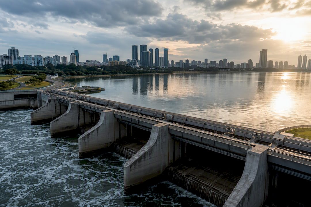
This single piece of infrastructure has measurably shrunk Singapore's flood-prone footprint, according to PUB's own account of the barrage's development. But it protects the bay basin as a whole. It doesn't reach into a private lobby with a blocked drain.
Statistic callout: PUB's Flood Resilience program treats coastal barriers and inland drainage as separate but linked layers of the same defense, because a barrage that holds back the sea does nothing for a clogged drain three streets inland.
Beyond the barrage itself, PUB runs a broader resilience program that includes:
- The Code of Practice on Surface Water Drainage, which sets minimum platform and crest levels for new buildings
- Scheduled upgrades to inland drainage capacity in known low-lying pockets
- Ongoing monitoring of rainfall intensity against drain capacity across the island
Marina Barrage and PUB's inland programs work together, not separately. One handles the sea side, the other handles what falls from the sky and where it goes once it lands. Neither one, on its own, eliminates the risk of a puddle turning into an inundated lobby if a drain hasn't been cleared in months.
What Property Owners Must Do: Drainage Duties and Practical Steps
PUB's Code of Practice on Surface Water Drainage sets the legal floor: developers must build to minimum platform and crest levels, and once the building is up, owners are on the hook for maintaining internal drains and gully traps. That obligation doesn't end at handover. It runs for as long as you own or manage the property.
A short, prioritized checklist for Marina Bay owners and facility managers:
- Clear internal drains and gully traps on a fixed schedule, not just when it rains.
- Book an annual contractor inspection of drainage lines, not a visual glance from the corridor.
- Keep dated maintenance records; PUB and town councils may ask for them after an incident.
- Check ground-floor entry points and access roads for pooling after any heavy rain event.
- Report blocked or damaged drains to PUB, your town council, or building management immediately, not after the next storm.
Pro Tip: Walk your building's perimeter drains right after a heavy downpour, not before one. Water still sitting an hour after rain has stopped is the clearest sign of a blockage you'll actually see in time to fix it.
Where to Check Official Flood Monitoring and Guidance
PUB's Flood Resilience page is the primary source for current flood-prone area lists, coastal and inland protection measures, and advisories. It's updated by the agency directly, which makes it more reliable than secondhand social media reports during an active storm.
For situational awareness before heavy weather hits:
- Check PUB's rainfall and drainage advisories alongside NEA's weather forecasts before planning outdoor work or deliveries
- Look up known flood hotspot areas listed on PUB's site if you manage a property near one
- Use PUB's official reporting channels or your town council's hotline to flag a blocked drain, rather than relying on word of mouth
- Treat official advisories as the trigger for action, not a news headline about a flood that already happened
Official channels move faster on verified data than crowd reports do, and PUB's own listings reflect actual drainage assessments rather than anecdote.
Climate Change and Marina Bay's Flood Outlook
Absolute flood prevention isn't realistic, and PUB doesn't pretend otherwise. Water engineers and PUB officials describe Singapore's approach as a layered system built around redundancy rather than a single perfect barrier. That's a deliberate choice, and it shapes what changes over the coming years.
Heavier rainfall and rising sea levels push more operational demand onto existing systems. Expect pumps at the Marina Barrage to run more often during high-tide rain events, since low-tide gravity discharge becomes less available as sea levels creep up. Inland drainage capacity gets revisited too, with upgrades targeted at known low-lying stretches rather than blanket citywide rebuilds.
What this means for different stakeholders:
- Government agencies will likely keep expanding inland drainage upgrades alongside coastal defenses, not instead of them
- Developers face tighter platform and crest level requirements on new projects in low-lying zones
- Owners and facility managers will carry more of the maintenance burden as extreme rainfall events become less rare
- Anyone evaluating flood-related climate risk for Marina Bay should treat drainage maintenance as increasingly non-optional, not a once-a-decade task
Facility managers thinking about extreme weather more broadly may find it useful to look at how other sectors plan for climate-driven risk, including approaches to protecting facilities against increasingly severe weather events.
The Geography Behind the Risk: Why Marina Bay Sits Low
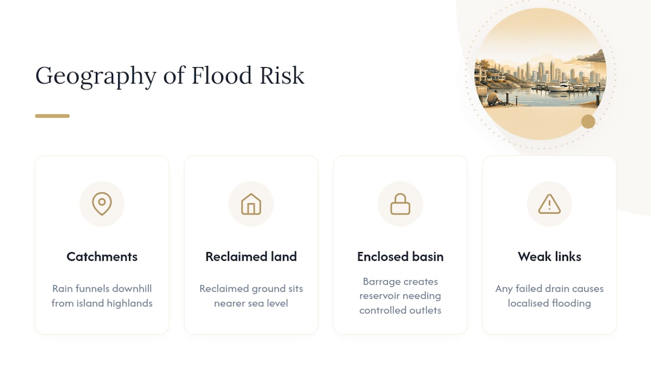
Marina Bay's flood exposure starts with its physical shape, not just its infrastructure. The bay sits at the mouth of several catchment areas that funnel rainwater downhill from higher ground across the central and southern parts of the island, and that water has nowhere to go but toward the coast.
Reclaimed land makes up a large share of the district, and reclaimed ground tends to sit closer to sea level than older, naturally elevated terrain. That's workable when drainage is designed correctly from the start, but it leaves less margin for error than you'd get in a hillier part of Singapore. A blocked drain in a low-lying reclaimed zone shows its effects faster because water simply has fewer places to disperse.
The bay itself functions as a partially enclosed basin now that the Marina Barrage separates it from the open sea. That's what allows PUB to hold the reservoir at a managed freshwater level rather than letting it fluctuate with the tide, but it also means every drop of rain that falls across the surrounding catchment eventually has to pass through a controlled system of channels, drains, and pumps before it reaches open water. Any weak link along that path, whether it's a construction site's runoff control or an aging internal drain in an older building, becomes a local flood point even while the bay as a whole stays protected.
Marina Bay's Flood History: What the Long-Term Pattern Shows
Marina Bay's flood story didn't start in March 2025. Before the barrage was completed in 2008, much of the low-lying land bordering the bay was genuinely flood-prone, and older Singapore residents remember a city with a far larger flood-prone footprint than exists today.
The barrage changed that baseline significantly by converting a tidal inlet into a controlled freshwater reservoir, cutting flood-prone land across Singapore by a wide margin according to PUB's own account of the project. That's the headline trend, and it's real. But the residual risk didn't disappear. It shifted from basin-wide tidal flooding toward localized, drainage-specific incidents tied to individual sites and buildings.
That shift explains why recent incidents look different from the flood stories of decades past. Older flood events tended to hit wide areas during major tidal surges. Recent incidents, including the March 2025 cases, are narrower in scope and tied to specific maintenance or design failures at particular locations. The long-term trend is fewer large-scale events and more scattered, site-specific ones. That's an improvement in aggregate risk, but it puts more weight on individual property owners to get their own piece of the system right, since the big infrastructure has already done most of the heavy lifting.
Public Awareness and Community Preparedness Programs
PUB doesn't just build infrastructure. It runs public-facing programs meant to keep residents, businesses, and facility managers informed before storms hit rather than after. The Flood Resilience initiative includes advisories and hotspot information specifically designed for public consumption, not just internal engineering use.
That public-facing layer matters because a lot of localized flooding traces back to private property maintenance, and PUB can't inspect every gully trap in every building. The agency's approach leans on making information accessible: clear advisories ahead of heavy rain, published lists of flood-prone areas, and straightforward channels for reporting blocked drains before they become a flooded lobby.
Town councils and building management corporations play a parallel role at the ground level, often relaying PUB advisories to residents and coordinating maintenance schedules for shared drainage infrastructure in condominiums and HDB estates. For residents and property owners, that shared-responsibility model means paying attention to advisories is worth the two minutes it takes, and reporting a slow drain doesn't require waiting for a flood to justify the call. Community awareness works best as a preventive habit rather than a reactive scramble once water is already rising.
Local Property Perspective: What Marina Bay Buyers Should Weigh
Waterfront visibility to the Marina Barrage genuinely adds appeal for buyers, but it shouldn't replace due diligence on the building itself. Ask any developer or management team about platform levels, drain maintenance schedules, and whether the property has had prior incidents. For a closer look at how infrastructure factors into local valuations, see our Marina Bay price trend analysis.
— Velisa
Sources
For live updates and rules, check PUB's Flood Resilience page, the Code of Practice summary via NCCS, and CNA's report on the March 2025 incidents. If you're weighing a purchase near the bay, our unit listings outline current availability across various layouts.
- Flood Resilience | PUB, Singapore's national water agency
- NCCS: Drainage and flood-prevention adaptation efforts
FAQ
Is Singapore at Risk of Rising Sea Levels?
Yes. Rising sea levels increase the operational demand on infrastructure like the Marina Barrage, since pumps have to work harder during high tide when gravity discharge isn't available.
What Are Some Low-Lying Areas in Singapore Prone to Flooding?
Marina Bay and Bedok Reservoir are both known low-lying zones where drainage failures caused flooding in March 2025, and PUB maintains a broader list of flood-prone hotspots on its Flood Resilience page.
Which Areas Are More Likely to Get Affected by Floods?
Areas combining low elevation, heavy or prolonged rainfall exposure, and older or poorly maintained drainage infrastructure face the highest risk, which is why PUB tracks specific hotspots rather than treating flood risk as uniform across the island.
When Was the Last Time Singapore Flooded?
The most recent widely reported flooding occurred in March 2025, when a monsoon surge caused flooding near Marina Bay MRT and at Bedok Reservoir due to inadequate and unmaintained drainage, according to PUB's own findings.